
May 28. Day 56 On to Oxford MD. 12.8 Nm. Total 1363 miles

 Last night took drone shots of our anchorage on St Michael’s.


Today we are going on a short run further up the Choptank River to the Tred Avon River and an  anchorage near Oxford,MD.  

The creeks we traveled to return the Choptank River are filled with crabbing boats that either drag their baskets on the side of the boat or using small nets to dip into the water.  When the baskets fill, they are hauled up and picked through with the small crabs returned to the water.

Oxford was established in 1683 as a port town that thrived through the Revolutionary War. Like St Michael’s, the town was built on shipbuilding, sail making, farming tobacco and vegetables, crabbing and oystering.  You can still watch the Oxford-Bellevue Ferry pick-up or discharge it’s passengers as it has for over 300 years.

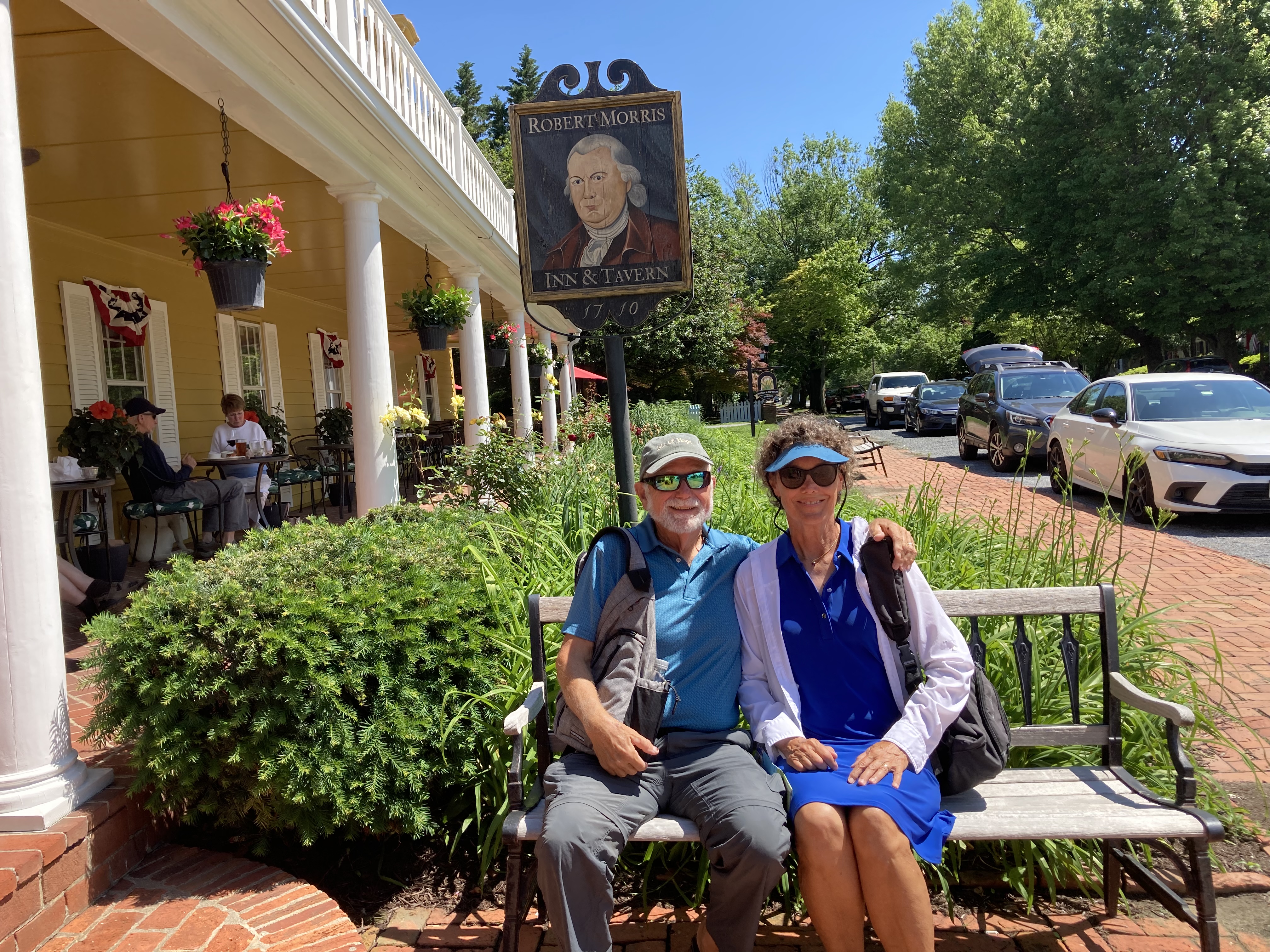
Oxford’s famous resident, Robert Morris built a house here in 1710, which has been incorporated into the Robert Morris Inn.  His son Robert Morris Jr was considered one the chief financiers for the Revolutionary War.


Entering the harbor you pass a number of marinas.  We got anchored and settled, just as we were getting ready to leave a young couple in a motorboat approached us asking about the Great Loop.  They had dreams of doing the Loop and asked us all kinds of questions.  We invited them aboard to see the boat.

Afterwards we launched the dinghy and headed for the Capsize restaurant.  There we had a seafood lunch that was delicious.  There was so much food that I will use the leftovers for dinner!  We were told by the locals that the ice cream shop next to the restaurant was a must do, so after our walk around town, we will indulge.  Never pass up good ice cream!

During our walk, we visited the Robert Morris Inn 


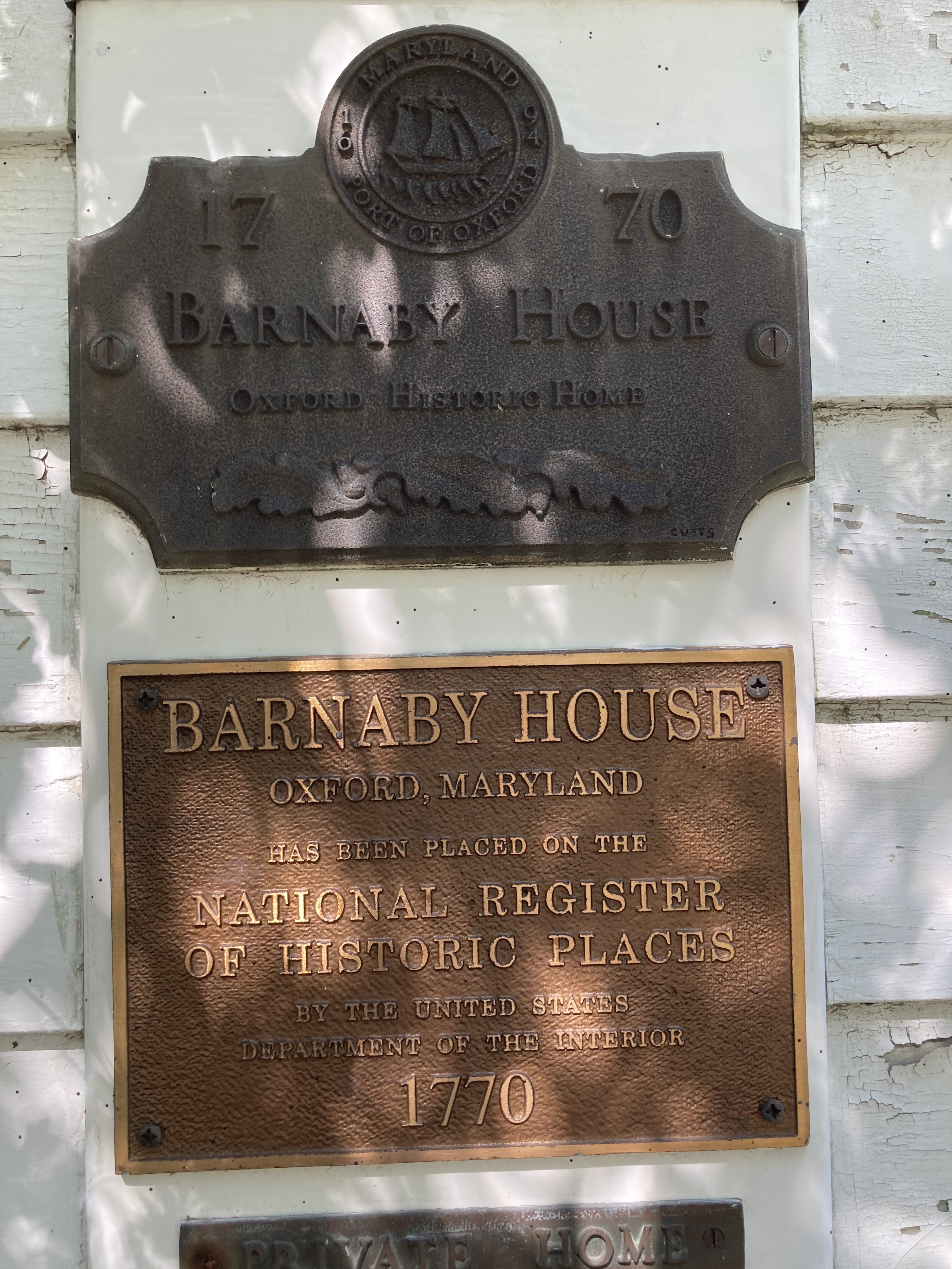
and homes of sea captains dating from 1770- 1898, all with white picket fences.


Watched the Oxford-Bellevue ferry in operation


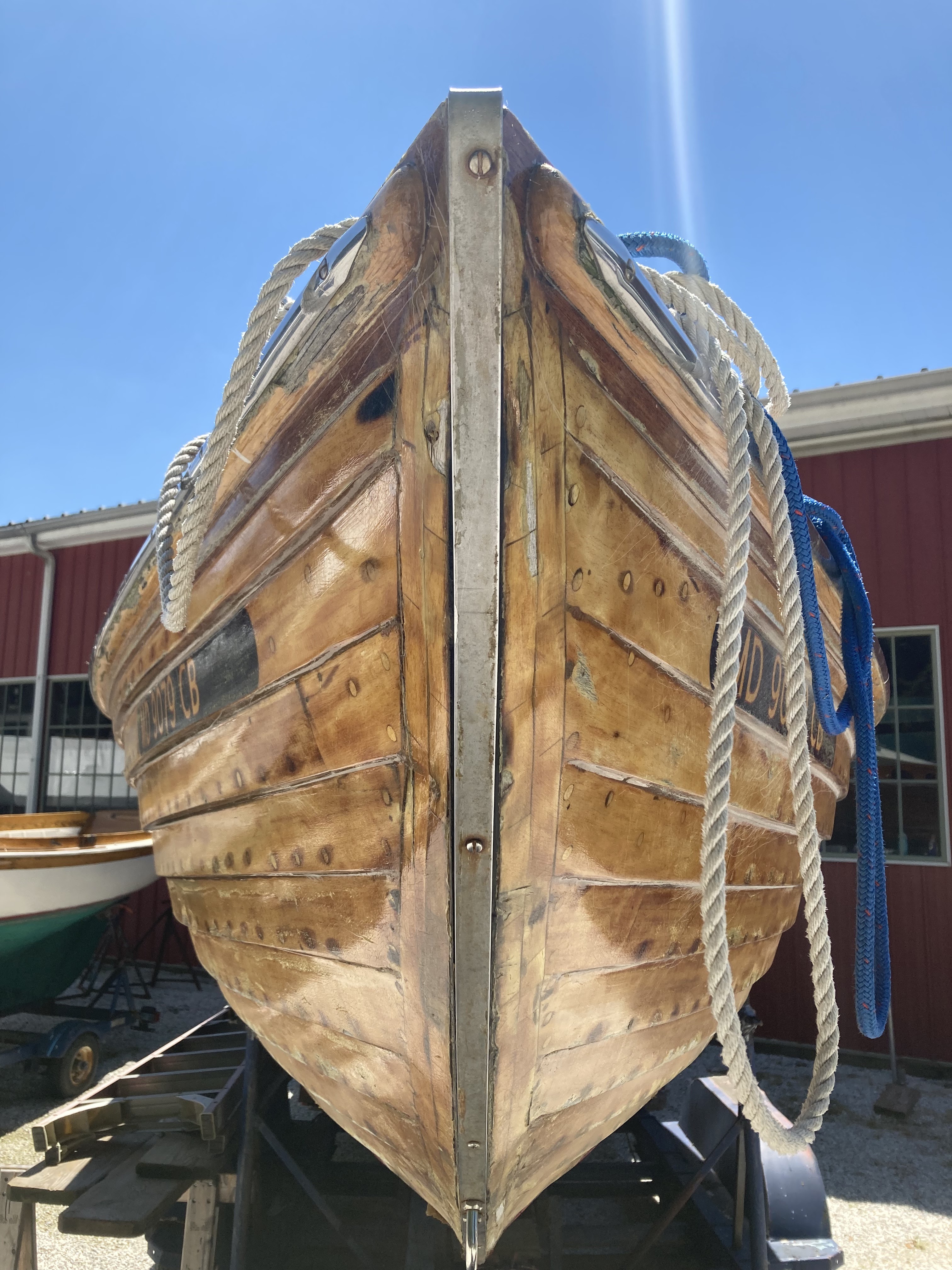
And wandered through the Cutts and Case Shipyard where they refurbish old wooden boats.


If you look closely thru the glass and expand the picture you will see the beautifully restored Foto.


Having finished our tour of Oxford we indulged in sharing ice cream.  


Then Bill took some more drone shots.  He is actually getting pretty good at controlling the drone and getting some excellent shots.


Popular posts from this blog

Reflections on the Bahamas

Reflections on the Bahamas Over the past 10 weeks, we have traveled through Abaco,  Eleuthera and Exuma Islands and enjoyed the hospitality of the Bahamian people.  We have learned all about the islands, its unique geography - limestone, caves, blue holes and chalk cliffs; and colorful history-pirates and rum running, salt ponds and cotton plantations, boat building and wrecking/salvage.  Traveling over 1300 miles through narrow cuts and wide bays to vast depths of ocean, we negotiated the islands and found safe harbors, calm coves for anchoring, bays filled with moorings and marinas large and small.  This trip required us to pay close attention to the weather, the tides and currents as we traveled between and through the islands. The Bahamian people are warm and friendly, willing to give us rides, advice and directions, as well as some secret recipes!!  We enjoyed hiking trails, walking the beaches, snorkeling the coral rocks and reefs, discovering ruins and ol...

June 4-5. Day 63-64. On to Cape May New Jersey. 53.4nm. Total 1534 miles.

 Left Delaware City at 5:35am to be able to take advantage of the strong currents going with us while traversing Delaware River and Delaware Bay. The Delaware River goes south about 15 miles and flows into the Delaware Bay. As we travel south, New Jersey is to the east and Delaware is to our west. We are traveling just outside the shipping channel and are really moving at 10.9 knots.  That is three knots faster than we normally travel, as the outgoing tides are pushing us along.  Nice to have Mother Nature helps us save on fuel.  The Delaware River is about 8 miles wide so there is plenty of room for the freighters and the pleasure boats.  So far, we have not encountered any commercial traffic, but there is a large freighter behind us that will eventually pass us as they travel at 14 knots. The Delaware Bay proper varies from 23-29 miles wide and 26 miles long.  There are five lighthouses on the Delaware marking the shipping channel.  We went by Ship J...

Day 98. 2nd year. August 27. On to Manistee. Miles 25 Total miles. 3910.

 We weighed anchor on a sunny 50 degree morning.  So we put on our sweatshirts and drove from below as we left Frankfort. Going through Frankfort’s channel and breakwater we encountered a few intrepid fisherman and further along as we cleared the breakwater there must have been over a hundred fishing boats.  Almost like playing bumper cars, but with boats.  Had to negotiate a path between them as the fishing boats were all trolling fishing lines behind them.  We were still seeing fishermen 4 miles south of Frankfort.  These guys sure take their fishing tournaments seriously! The shoreline that we pass heading south are still sand dunes bluffs some as tall as 200 feet. As we travel, we pass the small town of Arcadia and Portage Lake, each situated on an inland lake which is connected to Lake Michigan by a dredged channel.  Interesting to note that the dredged channels were originally small rivers connecting the inland lakes to Lake Michigan. As we passe...