
September 13-14 Day 149-150. On to Rome. 31.4 Nm. Total 2746 Then on to Sylvan Beach

 We woke to a cloudy morning leaving Little Falls.  We decided to go ahead and travel today knowing we may get rained on.   Traversing Lock 17 we were lifted 40.5 feet and four miles later in Lock 18 we were lifted another 20 feet.


The video below show the water in the lock as the flood gates open.

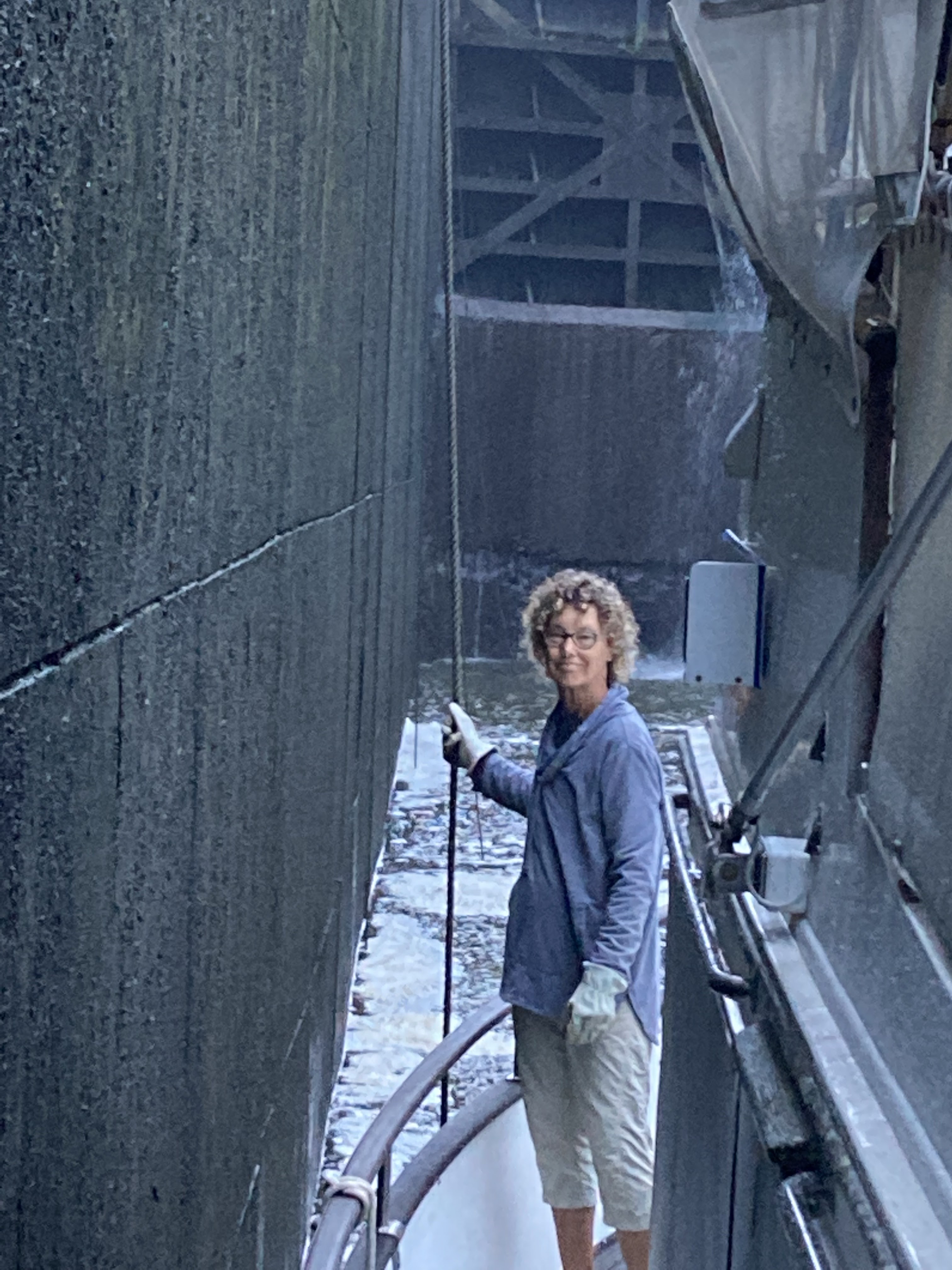
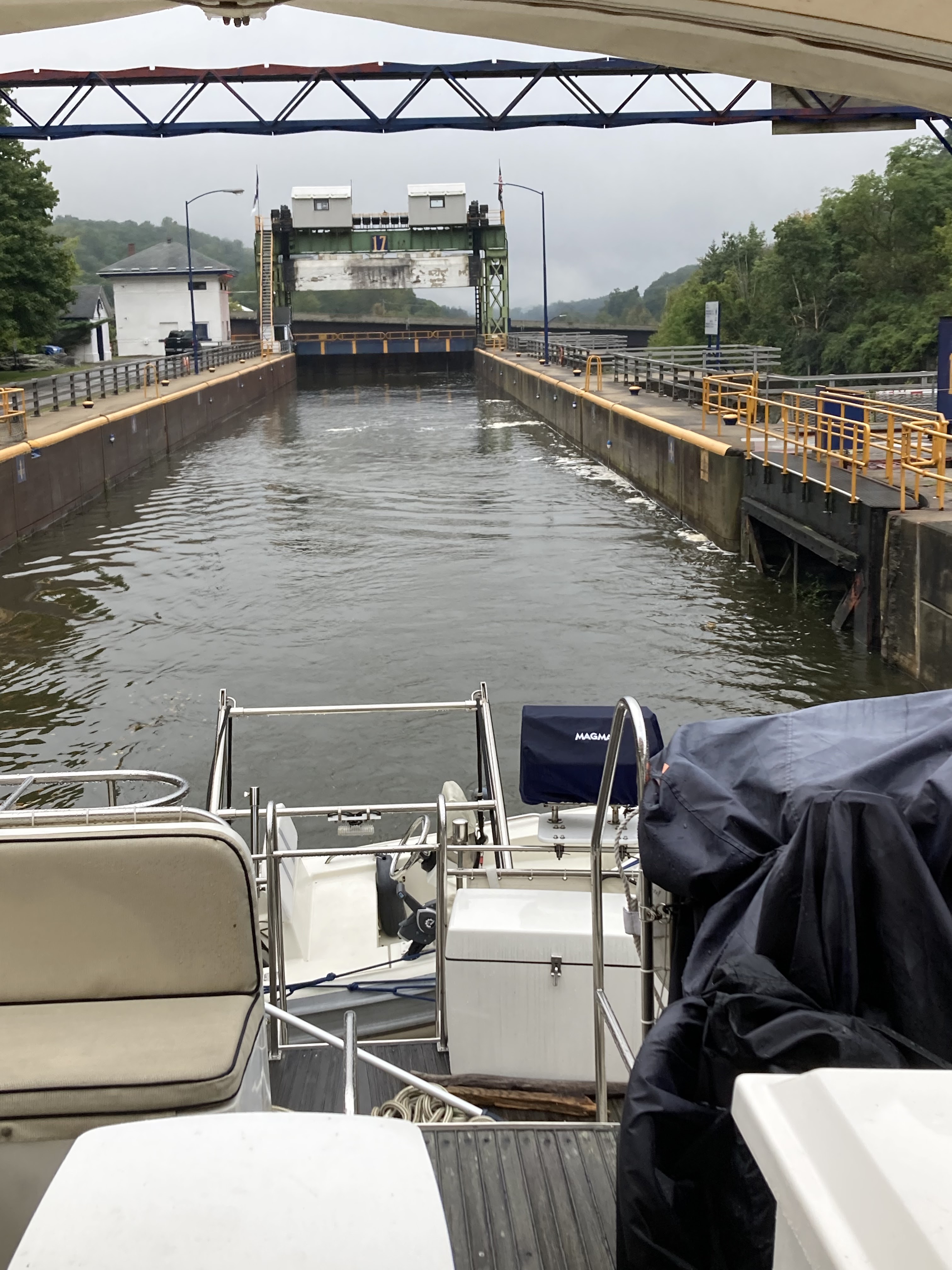
Photos of leaving Little Falls.
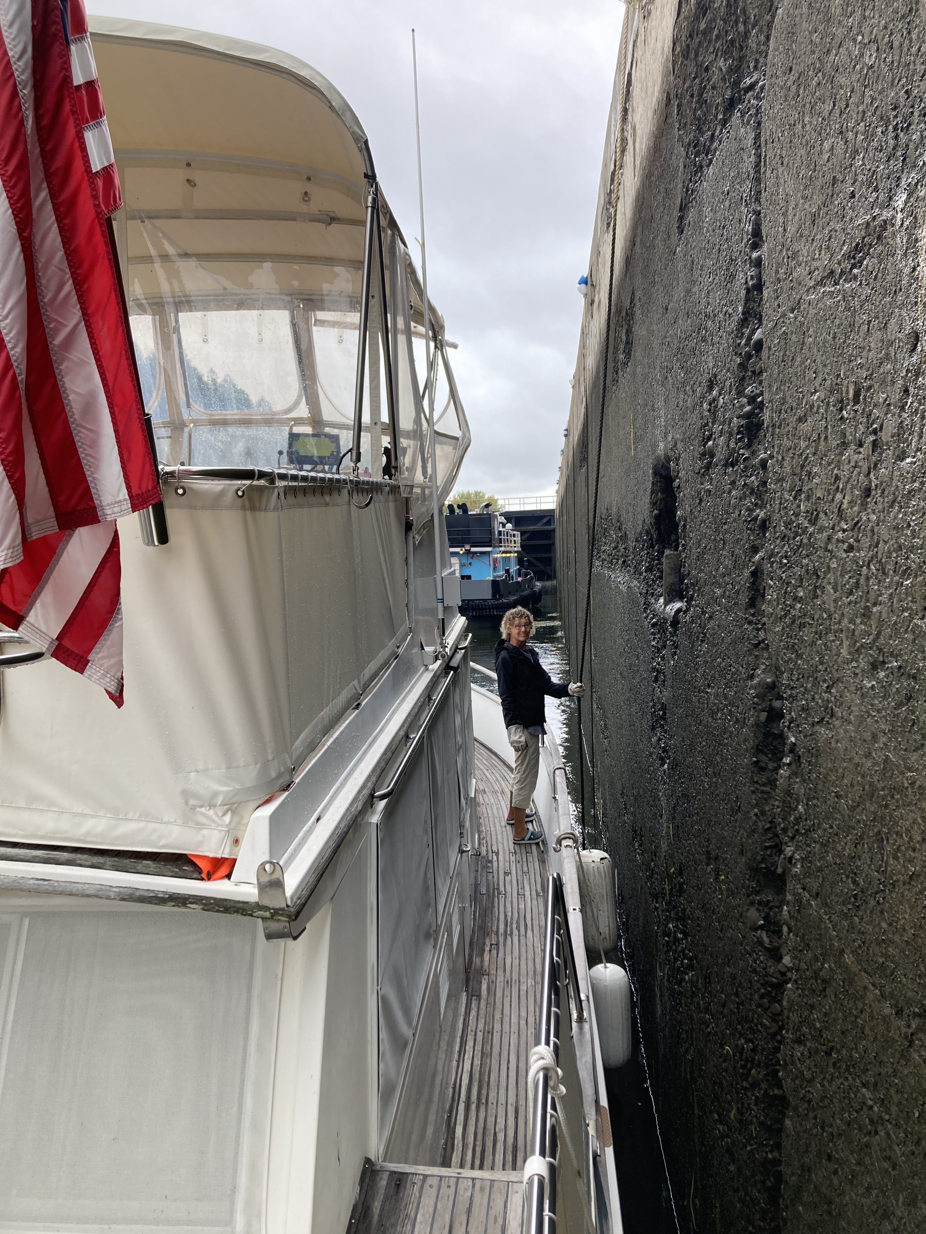
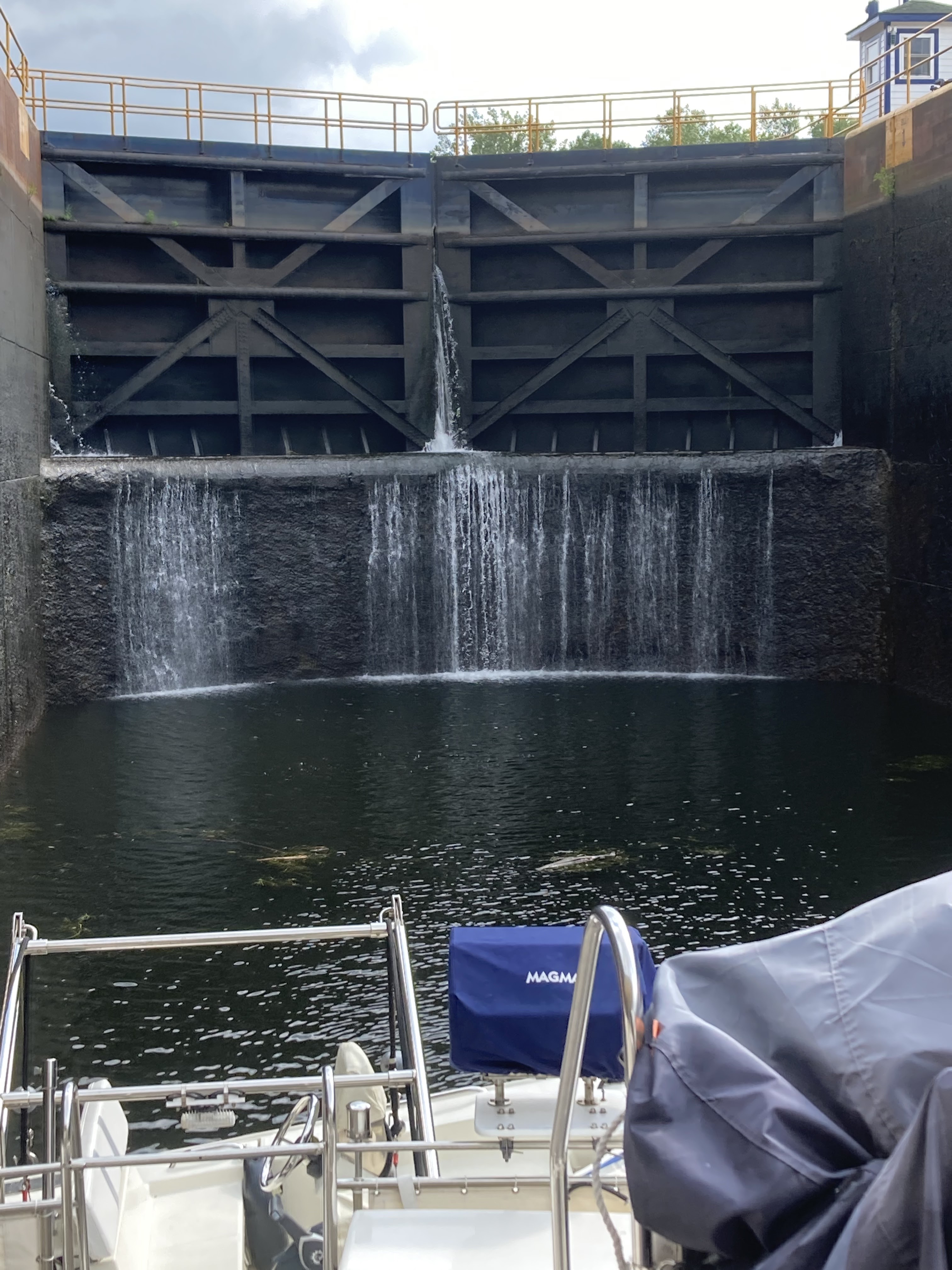


Lock 18 photos


Then the cloudy turned to a drizzly light rain, but thankfully it quit well before we got to the next lock twelve miles further on.  This section of the Erie is mostly man made canal so we have mostly straight channels.  Once we got to Lock 19 we rose 21feet.  Following the lock we encountered several dredging operations by the canal work boats. 


The sun actually peeked out as we approached the city of Utica.  Traveling further we shared Lock 20 with a good sized tugboat- J Arnold Witte, and rose another 16 feet.  So far we have risen a total of  424 feet on the Erie Canal.  


In our last leg of our trip today it began to rain.  As we are covered by the bimini  we stayed dry, but we slowed down due to decreased visibility.  Luckily it only lasted about 20 minutes and then stopped well before we tied up to the city free dock in Rome, NY.  Someone must have been watching over us today as we missed the rain during locking and while docking.  Also along this stretch we saw more signs of Fall.


This is a swampy area next to the canal.  Actually the canal is higher then this swamp.  Bill took the picture because of the white herons sitting in the trees.


We got things stored and picked up our umbrellas to walk into town.  We stopped here in Rome on our first run down the Erie so we are familiar with the town.  We patronized the same little sub and pizza place on Dominick Street- Cianfrocco’s.  Split a sub and enjoyed eating there a second time.


We then walked down to Fort Stanwix and had fun remembering the fort and how Bill got into Revolutionary War reenacting with the uniforms and weapons.   As we left the fort, Bill eyed a grocery store and decided that he had to have a cookie.  So we headed in that direction and obliged his cookie needs.  Afterwards we headed to the boat and got back just in time as it started to sprinkle. 


September 14.  Day 14.  On to Sylvan Beach.  Nm 12.5.  Total 2759 miles

Woke to a partly sunny day and 59 degrees.  Was wonderful to have the sun back again.   Will warm up to 65 but be quite breezy as a cold front is moving through. Needless to say we are layered with clothes to stay warm as we are traveling into the wind.


As we left Rome, we went under two bridges and a canal guard gate and through a long straight stretch of canal.  This part of the canal is all man made and is the highest point in the Eastern Erie.


The next two locks, Lock 21 and 22, drops us each 25 feet. 


Along the way we enjoyed the forested shores with its tinges of color, talking with the lockmasters and the geeses and ducks which paddled beside us.


Pulled up to the town wall at Sylvan Beach to tie up for the night.  There are eight other boats here, a change for us being the only boat moored. Everyone is waiting for the winds to die down so they can cross the Oneida Lake.


We walked into town and had lunch and walked back by Lake Oneida.  The town is mostly small rental homes and business to support the weekenders who come.  The town does a good job of having lots of activities to attract locals and weekend renters- from antique car shows, small concerts, art and craft festivals and an amusement park all on the lakefront park.


Chatted with other boaters as we made our way down the dock wall and came back to the boat to do chores.  I tackled the forward cabin cleaning and Bill did the fly bridge.


Popular posts from this blog

Day 24-25 April 15-16 On to Hopetown and Lay day in Hopetown. Miles 12.6. Total 460.6

Day 24 We had a change of plans.  Our friends who we met cruising the Loop, Trisha and Mike, are traveling north through the Bahamas and are close, so we will join then in Hope Town.   We will then back track a bit to visit Man-o-War Cay and Marsh Harbor after visiting with them. It is a bright sunny day with light winds as we weigh anchor to leave Great Guana. There is lots of freight and commercial traffic today- tugs and barges, large freighters and flat bed delivery boats.  It takes all these to handle the shipping needs and construction on the islands. We trip today took along the north east side of Great Guana and then past Scotland Cay, which is all privately owned.  Next we passed Fowl Cay which is a nature preserve known for its diving.  Following Fowl Cay is Man-o-War Channel with its deep water access to the Atlantic and Man-o-War Cay, known for its ship building and maintenance. Sorry, pictures of the passes and islands did not turn out too well...

On to Allan's-Pensacola Cay. Day 12. April 3. Mile 35.2. Total mile

  Day 12 We left our anchorage at sunrise to head out of Great Sale Cay Harbor. Turning west and then north, we will cruise around Great Sale Cay toward Abaco's barrier islands, eventually reaching the eastern edge of the Little Bahama Bank today. As we turn Northeast, we get some spray.  Crustacean is quite salty now!   Winds are out of the east 10-15 knots with waves at one foot. We cruise past Little Sale Cay we see a steady stream of sailboats going both east and west.  I counted 15 total.  Nice wind for sailing. Halfway through our trip, you begin to see the outer barrier islands on the horizon to the north.  Five miles later you can see Little Abaco Island to our south.  Here is a chart of the area we traveled from Great Sale to Allan's-Pensacola Cay today. The further we travel east, the Little Bahama Bank narrows,  The winds pick up and seas run 1-2 feet. Crustacean got even saltier! As we approached Allan's-Pensacola the wind and sea...

June 4-5. Day 63-64. On to Cape May New Jersey. 53.4nm. Total 1534 miles.

 Left Delaware City at 5:35am to be able to take advantage of the strong currents going with us while traversing Delaware River and Delaware Bay. The Delaware River goes south about 15 miles and flows into the Delaware Bay. As we travel south, New Jersey is to the east and Delaware is to our west. We are traveling just outside the shipping channel and are really moving at 10.9 knots.  That is three knots faster than we normally travel, as the outgoing tides are pushing us along.  Nice to have Mother Nature helps us save on fuel.  The Delaware River is about 8 miles wide so there is plenty of room for the freighters and the pleasure boats.  So far, we have not encountered any commercial traffic, but there is a large freighter behind us that will eventually pass us as they travel at 14 knots. The Delaware Bay proper varies from 23-29 miles wide and 26 miles long.  There are five lighthouses on the Delaware marking the shipping channel.  We went by Ship J...