
Lay day in Stuart and on to Lake Worth March 29-30. Day 7-8. MIles. 33.8. Total 254.5

Day 7

 Our weather window looks to be next Tuesday, so we opted to stay one more day in Stuart to avoid sitting in a more open anchorage in Lake Worth for too long.  We figured the weekend boaters will be less later Sunday afternoon when we arrive at our anchorage in the lake.

We spent the morning with figuring out an electrical hiccup, repairing screens, and installing a guard for our electronics in the flybridge and a radar reflector on the boat.

After lunch, we went ashore to walk around the old part of the city waterfront and maybe even find some ice cream!
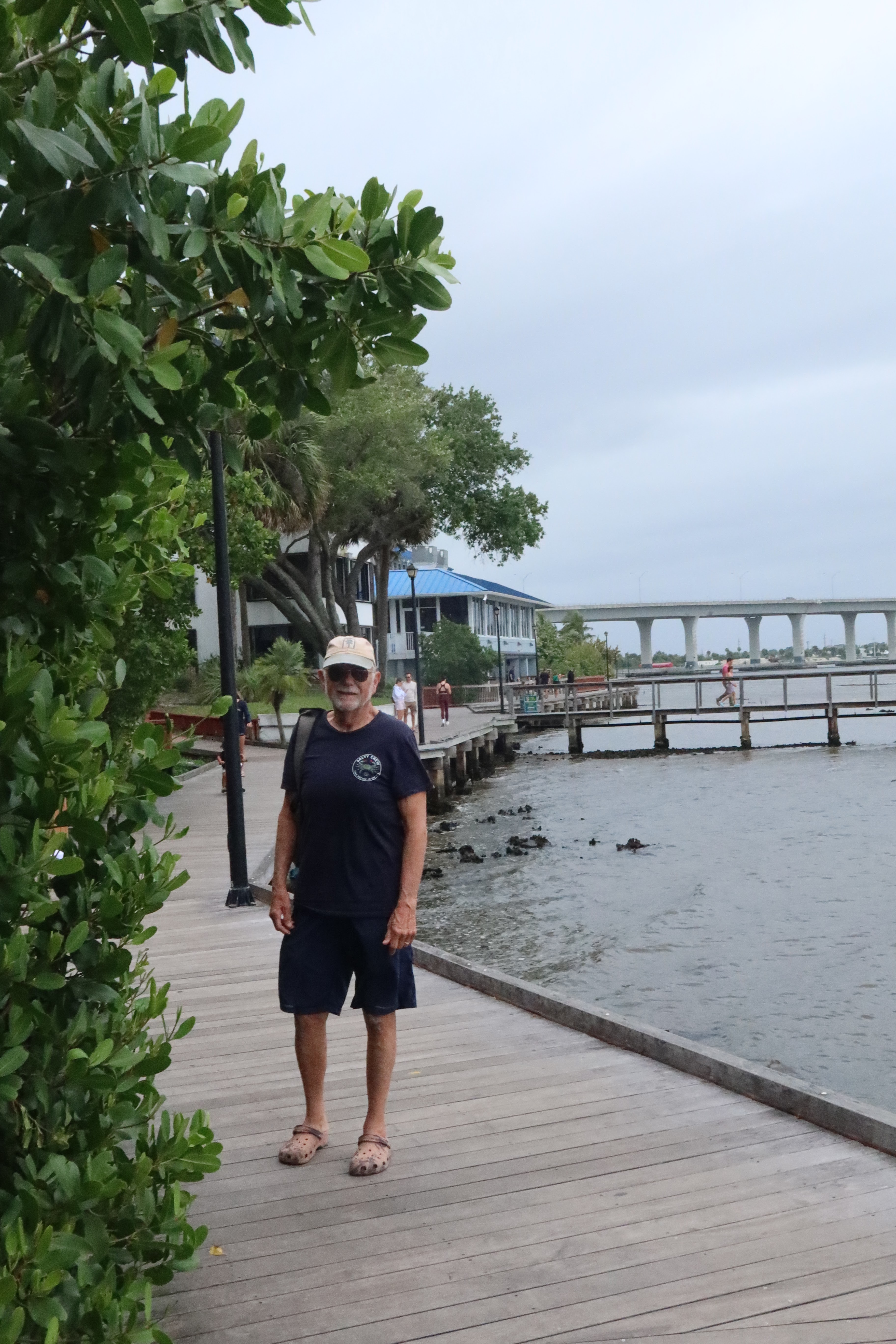

We walked the waterfront boardwalk from the marina to the old town.  Stuart is a good sized town that serves the fishing and boating enthusiasts that live in the area.  There were lots of restaurants and cute shops as we walked the town.  Feeling a bit hungry we stopped into a pub and had an appetizer before walking back to the marina.  On the way back we make sure to see the statue of a sailfish - As Stuart is the "Sailfishing Capitol of the World"


Day 8. On to Lake Worth.  

We left our mooring and went to the fuel dock to top off our diesel and water.


Leaving the fuel dock, we waited for a passenger train and freight train to pass so our bridge can open for us.  After a 15 minute wait, we headed east under the railroad and bascule bridges to continue on the St Lucie River. Along the way, we passed the old city of Stuart's waterfront and a shoreline filled with homes.


The St Lucie River ends in the narrow inlet, and we turned south to join the Atlantic Intracoastal Waterway.  We passed an osprey family with chicks nesting on a navigational mark.  Look close in the second shot to see the chicks in the nest


At first, we pass the barrier island which is natural, part of the Hobe Sound Nature Preserve.  the mainland side is filled with homes and condos.


Traveling further south we came to the Jupiter Inlet and its iconic lighthouse.


Continuing past the lighthouse, the waterway becomes a mangrove lined, with homes and condos further off the water.  The mangroves give way to concrete seawalls with homes and condos.  Soon we go under a bridge and the Intracoastal widens and turns into Lake Worth.  We are now in the big city with its tall condos on the beach and expensive homes along the Intracoastal. 


We found a crowded anchorage where we settled in for the night.  the anchorage is just north of the inlet we will travel through as we leave for the Bahamas.


Popular posts from this blog

Reflections on the Bahamas

Reflections on the Bahamas Over the past 10 weeks, we have traveled through Abaco,  Eleuthera and Exuma Islands and enjoyed the hospitality of the Bahamian people.  We have learned all about the islands, its unique geography - limestone, caves, blue holes and chalk cliffs; and colorful history-pirates and rum running, salt ponds and cotton plantations, boat building and wrecking/salvage.  Traveling over 1300 miles through narrow cuts and wide bays to vast depths of ocean, we negotiated the islands and found safe harbors, calm coves for anchoring, bays filled with moorings and marinas large and small.  This trip required us to pay close attention to the weather, the tides and currents as we traveled between and through the islands. The Bahamian people are warm and friendly, willing to give us rides, advice and directions, as well as some secret recipes!!  We enjoyed hiking trails, walking the beaches, snorkeling the coral rocks and reefs, discovering ruins and ol...

June 4-5. Day 63-64. On to Cape May New Jersey. 53.4nm. Total 1534 miles.

 Left Delaware City at 5:35am to be able to take advantage of the strong currents going with us while traversing Delaware River and Delaware Bay. The Delaware River goes south about 15 miles and flows into the Delaware Bay. As we travel south, New Jersey is to the east and Delaware is to our west. We are traveling just outside the shipping channel and are really moving at 10.9 knots.  That is three knots faster than we normally travel, as the outgoing tides are pushing us along.  Nice to have Mother Nature helps us save on fuel.  The Delaware River is about 8 miles wide so there is plenty of room for the freighters and the pleasure boats.  So far, we have not encountered any commercial traffic, but there is a large freighter behind us that will eventually pass us as they travel at 14 knots. The Delaware Bay proper varies from 23-29 miles wide and 26 miles long.  There are five lighthouses on the Delaware marking the shipping channel.  We went by Ship J...

Day 98. 2nd year. August 27. On to Manistee. Miles 25 Total miles. 3910.

 We weighed anchor on a sunny 50 degree morning.  So we put on our sweatshirts and drove from below as we left Frankfort. Going through Frankfort’s channel and breakwater we encountered a few intrepid fisherman and further along as we cleared the breakwater there must have been over a hundred fishing boats.  Almost like playing bumper cars, but with boats.  Had to negotiate a path between them as the fishing boats were all trolling fishing lines behind them.  We were still seeing fishermen 4 miles south of Frankfort.  These guys sure take their fishing tournaments seriously! The shoreline that we pass heading south are still sand dunes bluffs some as tall as 200 feet. As we travel, we pass the small town of Arcadia and Portage Lake, each situated on an inland lake which is connected to Lake Michigan by a dredged channel.  Interesting to note that the dredged channels were originally small rivers connecting the inland lakes to Lake Michigan. As we passe...